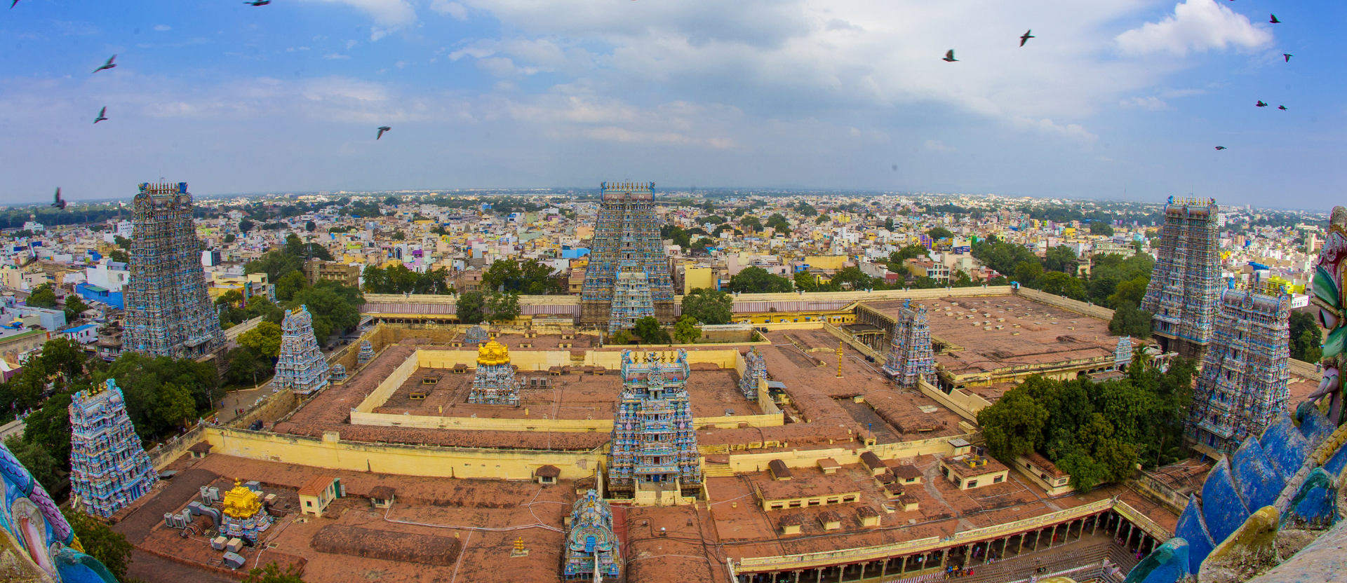
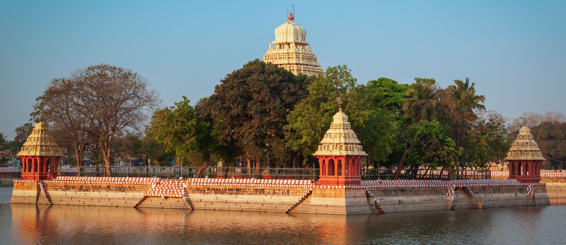
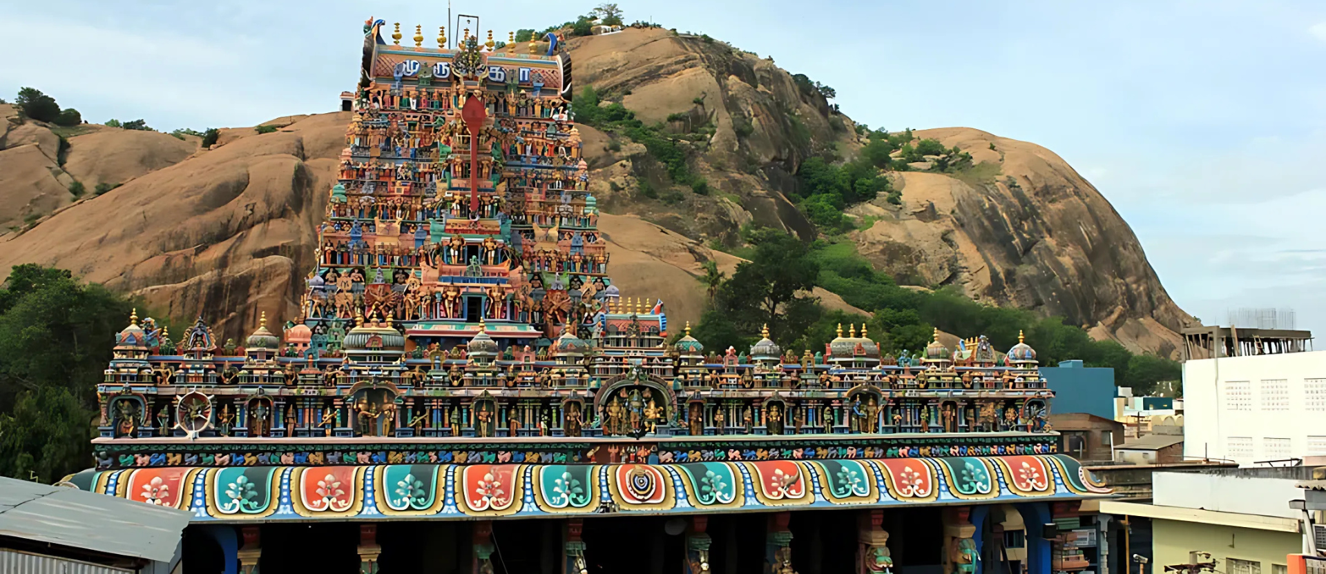
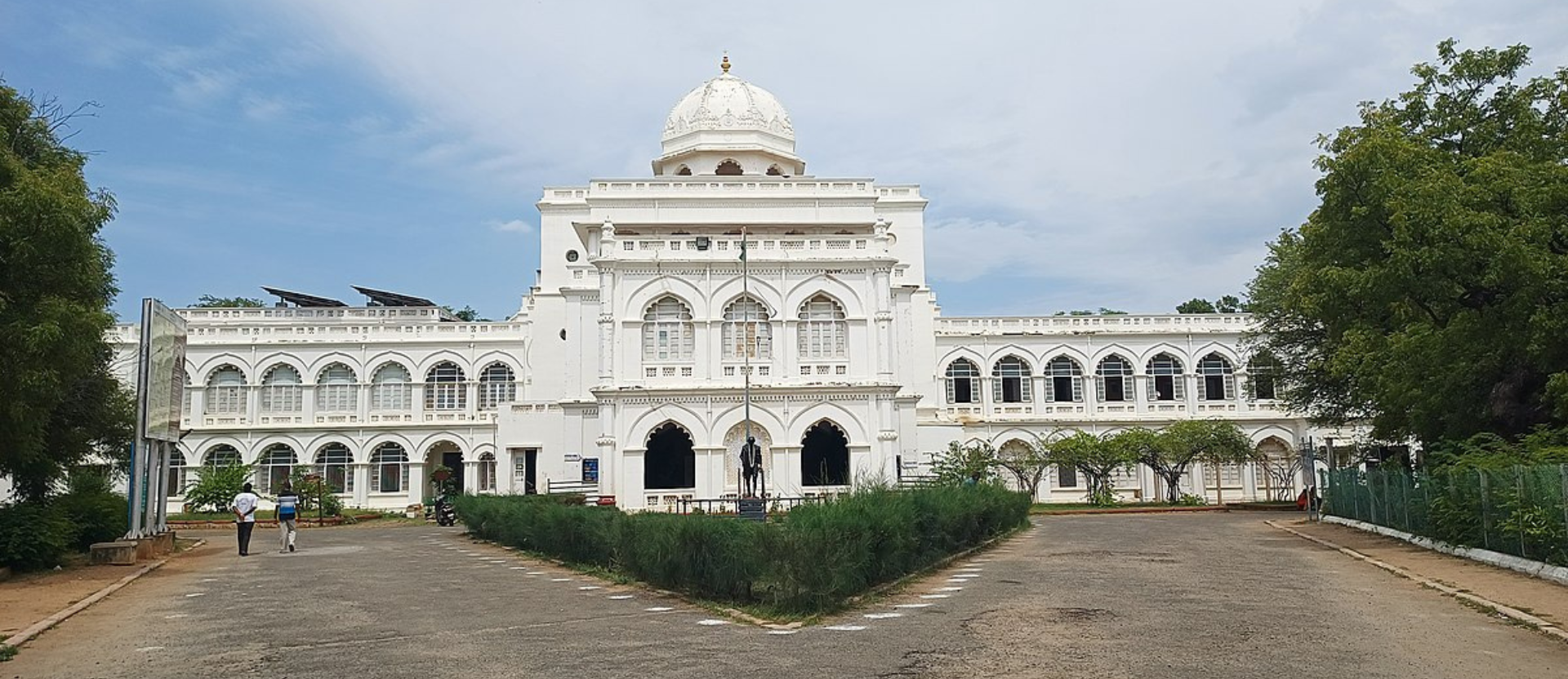
Madurai is not just a city but a living museum of Tamil culture, history, and spirituality. Known for its nickname, “Athens of the East”, it has been a prominent center of Tamil civilization and a seat of learning since the Sangam era. The city’s skyline is dominated by the towering gopurams of the Meenakshi Amman Temple, which draw millions of devotees and tourists every year. Alongside this, the Thirumalai Nayakkar Palace showcases the grandeur of the Nayak dynasty, blending Dravidian and Islamic architectural styles.
Madurai’s economy is a mix of tradition and innovation. It is a leading exporter of handloom textiles, automobile parts, and the fragrant Madurai Malli (jasmine flowers), which is in high demand across the globe. The city’s bustling bazaars, such as the Vilakkuthoon area, reflect its long-standing reputation as a trade hub. Night markets are alive with food vendors, offering culinary delights like Jigarthanda, Kari Dosa, and traditional banana-leaf meals.
Madurai is also an educational and healthcare hub, housing reputed institutions like Madurai Kamaraj University and renowned medical centers like Aravind Eye Hospital, which has become a global leader in eye care. In recent years, the city has seen rapid urbanization with smart city projects focusing on infrastructure, green spaces, and sustainable development, ensuring that modernity complements its historic character.
The city’s connectivity makes it easily accessible, with the Madurai International Airport offering flights to domestic and international destinations, and its railway junction being one of the busiest in South India. As a gateway to Tamil Nadu’s cultural and natural attractions, Madurai is close to popular destinations like Rameswaram, Kodaikanal, and Thekkady, enhancing its appeal to travelers and also Known as the “City That Never Sleeps”, Madurai’s charm lies in its ability to embrace the future while holding on to its rich heritage.
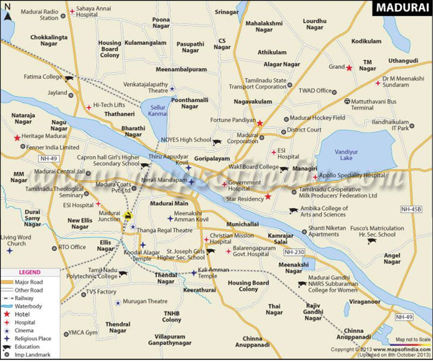
Madurai City Map
CONNECTIVITY AND LINKAGES
ROAD NETWORK
The National Highways NH 7, NH 45B, NH 208 and NH 49 pass through Madurai. The state highways passing through the city are SH-32, SH-33 and SH-72, which connect various parts of Madurai district. Madurai is one of the seven circles of Tamil Nadu State Highway network. Madurai is the headquarters of the Tamil Nadu State Transport Corporation (Madurai) and provides local and intercity bus transport across seven districts namely Madurai, Dindigul, Theni, Virudhunagar, Tirunelveli, Thoothukudi and Kanyakumari. Madurai has four major bus stands, namely, M.G.R Bus Stand Integrated Bus Terminus (MIBT), Arappalayam, Palanganatham and Periyar Bus stand.
RAILWAY NETWORK
Madurai Junction is an important railway junction in south Tamil Nadu and constitutes a separate division of the Southern Railway. There are direct trains from Madurai connecting the important cities in Tamil Nadu like Chennai, Coimbatore, Kanyakumari, Trichy, Tirunelveli, Karaikudi, Mayiladuthurai, Rameswaram, Thanjavur and Vriddhachalam.Madurai has rail connectivity with important cities and towns in India. The state government has announced Mono rail project for Madurai in 2011, which is in planning stages.
CONNECTIVITY AND LINKAGES MAP OF MADURAI
MADURAI AIR NETWORK
Madurai International Airport is located 12 kilometers from the city. It offers domestic flight services to major cities in India and international services to Colombo, Sri Lanka (beginning September 20, 2012). The carriers operating from the airport are Air India, Jet Airways and SpiceJet. The airport handled 5.2 lakhs passengers during Apr 2011 to Mar 2012.
MADURAI CONSTITUTION
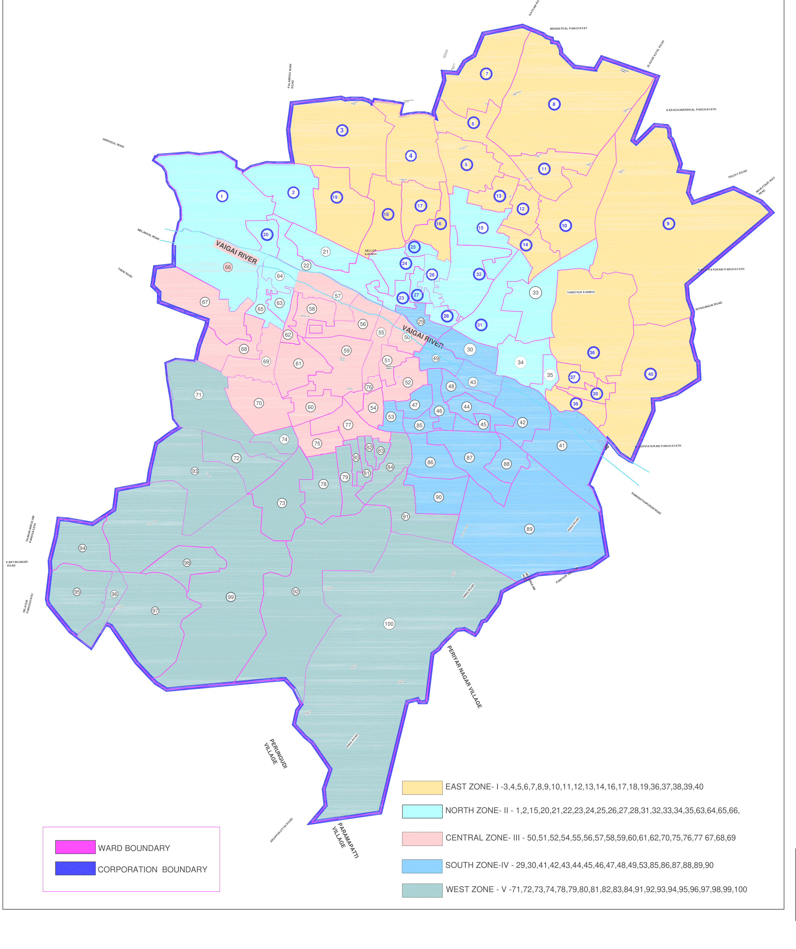
The municipality of Madurai was constituted on 1 November 1866 as per the Town Improvement Act of 1865.The municipality was headed by a chairperson and elections were regularly conducted for the post except during the period 1891 to 1896, when no elections were held due to violent factionalism. In 2011, the jurisdiction of the Madurai Corporation was expanded from 72 wards to 100 wards covering area 147.99 Sq.Km, dividing into four regions-Zone I, II, III, IV. The functions of the municipality are devolved into six departments: General, Engineering, Revenue, Public Health, Town planning and the Computer Wing. All these departments are under the control of a Municipal Commissioner who is the supreme executive head. legislative powers are vested in a body of 100 members, one each from the 100 wards. The legislative body is headed by an elected Mayor assisted by a Deputy Mayor.
MUNICIPAL AREA
Madurai Corporation is the second largest Municipal Corporation in the state of Tamil Nadu. Madurai was constituted as a municipality as per the Town Improvement Act of 1865 on 1st November 1866. It was upgraded as a Corporation on 1st May, 1971 in view of rapid increase in population and extension of administrative boundaries.
The jurisdiction of Madurai Corporation has been extended on 28th September 2010, to include the areas of the city Corporation, 3 Municipalities, 3 Town Panchayats and 11 Village Panchayats located around the Madurai Corporation. Consequent to this extension, the total area of the Corporation has increased considerably from 51.82 Sq.KM to 147.997 Sq.Km and the numbers of the wards have increased from 72 to 100. The extended Municipal Corporation had a population of 14, 70,755 persons as per 2011 census.